Seville neighborhood map
You can find on this page the Seville neighborhood map to print and to download in PDF. The Seville districts map presents quarters, region, suburbs and surrounding area of Seville in Spain.
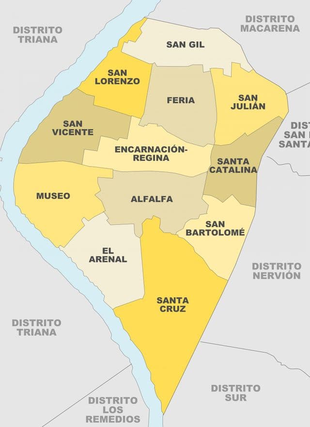
Seville neighborhoods map
The Seville neighborhoods map shows region and suburbs of Seville areas. This neighborhood map of Seville will allow you to discover quarters and surrounding area of Seville in Spain. The Seville quarters map is downloadable in PDF, printable and free.
The economic activity of Seville cannot be detached from the geographical and urban context of the city; the capital of Andalusia is the centre of a growing metropolitan area. Aside from traditional neighborhoods such as Santa Cruz, Triana and others, those further away from the centre, such as Nervión, Sevilla Este, and El Porvenir have seen recent economic growth as its mentioned in Seville neighborhoods map.
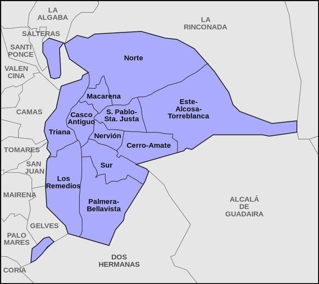
Seville districts map
The Seville districts map shows all quarters and suburbs of Seville. This district map of Seville will allow you to discover areas and the region of Seville in Spain. The Seville districts map is downloadable in PDF, printable and free.
Seville has 11 districts as you can see in Seville districts map. Bellavista – La Palmera, is one of the southernmost districts of the city, bordering the municipality of Dos Hermanas. Casco Antiguo, This is where most of the tourist attraction sites of Seville are located, such as the historical monuments (the Cathedral, Giralda, Real Alcazar, Basilica de la Macarena, Archivo de Indias …). Cerro – Amate, The district is now one of the most populous areas in the city and it borders the municipality of Alcalá de Guadaira. Este – Alcosa – Torreblanca, This is the easternmost of the Seville districts and also the one with the largest population.