Seville streets map
You can find on this page the Seville streets map to print and to download in PDF. The Seville roads map presents the road network, main roads, routes and motorways of Seville in Spain.
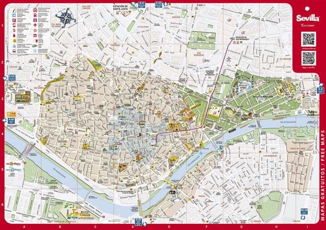
Seville streets map
The Seville streets map shows all street network and main roads of Seville. This streets map of Seville will allow you to find your routes through the streets of Seville in Spain. The Seville streets map is downloadable in PDF, printable and free.
The city old Jewish quarter is one of Seville most charming areas, characterized by narrow, cobbled streets, fountain-filled plazas, white-washed buildings and streets lined with orange trees (see Seville streets map). It is also one of the most popular barrios for tourists, being home to some of Seville best sights, including the UNESCO World Heritage Royal Alcázar – the Moorish palace, dating back to the 1300s – and the famous La Giralda Cathedral, with an old minaret for its bell tower. Spend your time here getting lost among its maze of streets, stopping off at tapas bars along the way and admiring its attractive architecture.
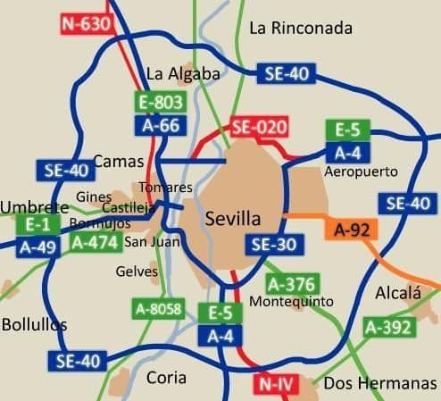
Seville roads map
The Seville roads map shows all road network and highways of Seville. This roads map of Seville will allow you to find your routes through the roads and motorways of Seville in Spain. The Seville roads map is downloadable in PDF, printable and free.
The province of Seville has a wide network of roads and is well connected to other provinces of Andalusia and Spain as its mentioned in Seville roads map. National Road N-IV, known as Road of Andalusia, it has a section which links Dos Hermanas with Jerez de la Frontera in the south and Cordoba in the north. Autopista del Quinto Centenario (A-49), this highway links Seville with Huelva and Portugal, being the main access road to this country in the south of the peninsula.