Seville transport map
You can find on this page the Seville transport map to print and to download in PDF. The Seville transportation map presents the transports network and transport zones of the transit of Seville in Spain.
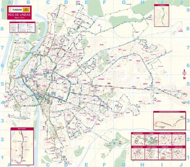
Seville transports map
The Seville transport map shows all means of transportation in Seville. This transports map of Seville will allow you to move easily with public transport of Seville in Spain. The Seville transportation map is downloadable in PDF, printable and free.
Seville, the fourth largest urban centre in Spain, was recently voted Lonely Planet number one city to visit in 2018 (see Seville transports map). The award made a point of mentioning Seville impressive network of bicycles and trams, but it neglected to mention that it is actually their ten year anniversary. Seville metro opened just two years later. This makes now an excellent time to look back on Seville public transport network – especially because almost all of it was completed in the middle of the global financial crisis.